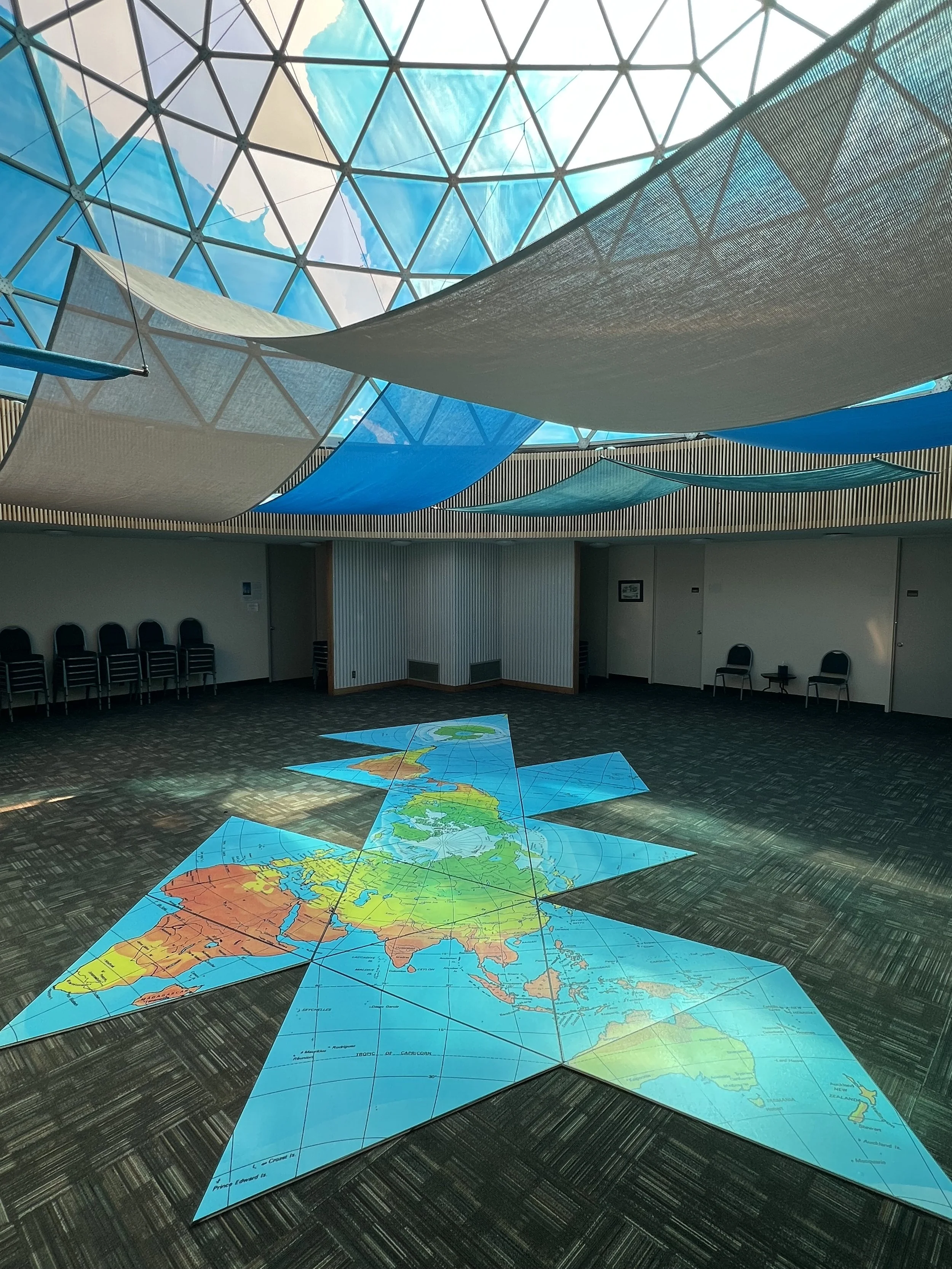
Fuller’s large format Dymaxion Map on the floor of the Fuller Dome at SIUE
The Fuller Dome as Extension of Your Classroom:
Anthropology – Buckminster Fuller’s Dymaxion Map's emphasis on interconnectedness, its ability to provide new perspectives, and its potential for visualizing complex data align with the academic pursuits of anthropology. This more accurate world map is a useful aid in studying people's movements, migration, and the connections between human societies across the globe.
Emphasizing interconnectedness:
Challenging traditional perspectives: Fuller developed the Dymaxion map to address the distortions and biases inherent in conventional maps like the Mercator projection, which tend to emphasize separation and division.
Visualizing "One-World Island": The Dymaxion map presents the Earth's continents as a nearly continuous landmass, emphasizing the interconnectedness of human populations and encouraging a holistic view of the planet.
Understanding global movements: This perspective can be valuable in studying large-scale migrations, cultural exchange, and the spread of ideas and technologies across the globe, as the map helps to visualize the potential pathways and connections between different regions.
Facilitating new ways of thinking:
A conceptual tool: Fuller considered the Dymaxion map a tool to facilitate new ways of thinking about the world and addressing global challenges.
Visualizing human movements: By reducing the visual distortion of traditional maps, the Dymaxion map allows for more accurate visualization of population distribution and resource availability, providing a more informed basis for analyzing patterns of human movement and migration.
Understanding resource distribution: The map's ability to display percentages of resources and population accurately can be crucial for studying the impact of resource distribution on migration and settlement patterns.
Potential for visualizing complex data:
World Game: Fuller's World Game, which utilized a large-scale Dymaxion map, envisioned a system for visualizing and managing global resources and problems.
Mapping human movements: This suggests the potential for using the Dymaxion map to visually represent complex anthropological data, such as migration routes, cultural diffusion, and the historical movements of specific groups.