The Geoscope Invites You to Shift Your World View
Buckminster Fuller’s miniature-earth Geoscope on the SIUE campus
Buckminster Fuller's Geoscope; proposed a large, geodesic spherical miniature Earth that would be connected to computers and display real-time data, allowing users to visualize global patterns related to resources, population, pollution, and other factors. Its purpose is to help people understand their place in the world, see the interconnectedness of global events, and foster a sense of shared responsibility for the planet.
The Geoscope was envisioned as a 3-dimensional immersive version of Fuller's "World Peace Game" concept, a simulation of the planet and its resources, where designers, engineers, students, and politicians could explore novel solutions for making the world work for everyone. Fuller envisioned Geoscopes suspended over major cities worldwide, acting as constant reminders of global interconnectedness and providing a platform for collaborative problem-solving.
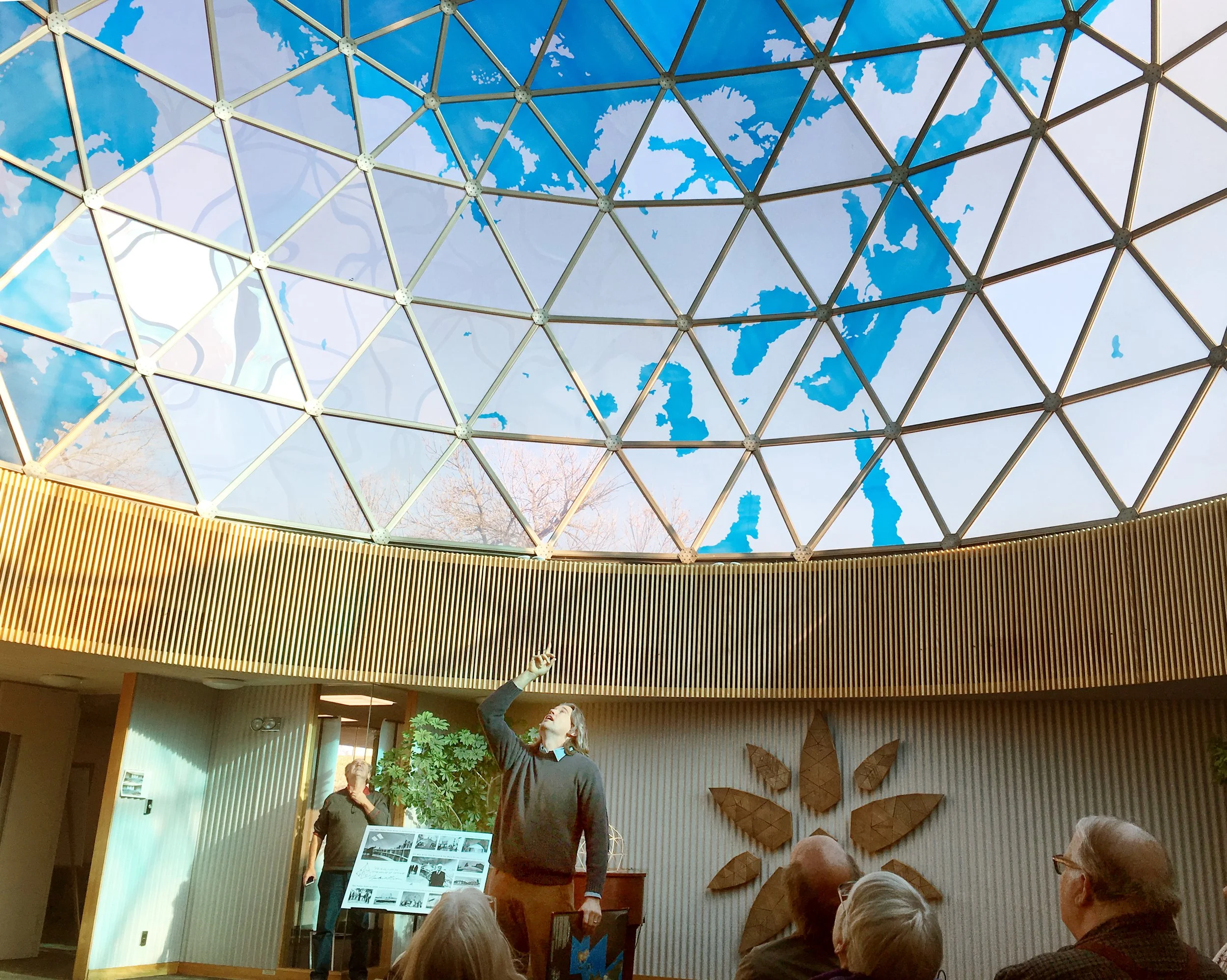
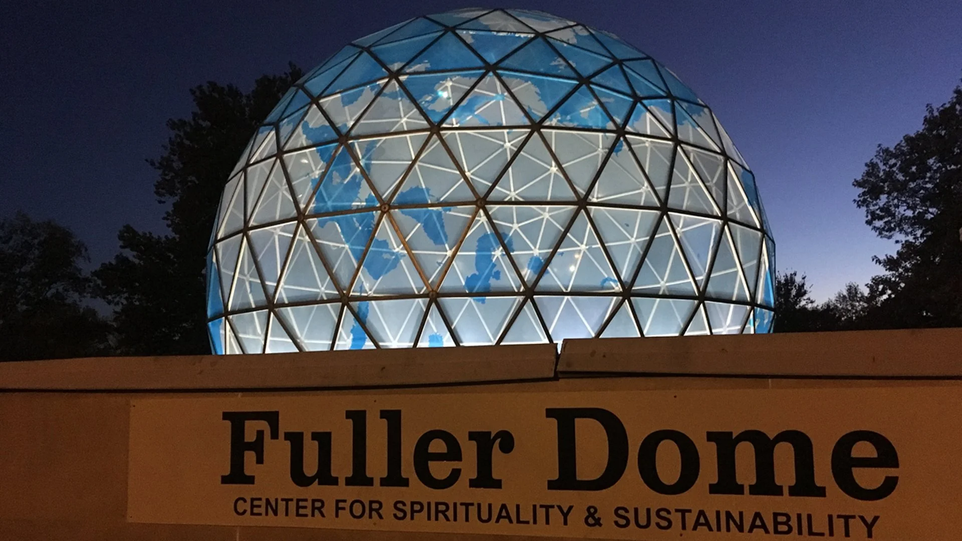
In the early 1960’s Fuller proposed a 400-foot diameter Geoscope for the SIUE campus. This Geoscope named by Fuller as the World Resource Simulation Center wasn't built on the SIUE campus or fully realized anywhere, but the 40-foot diameter miniature-earth Fuller Dome was built in 1971 on the SIUE campus by Fuller and Shoji Sadao. Although Fuller never fully realized the data visualization aspects of his Geoscope ideas in the Fuller Dome, it can be seen as a precursor to the Las Vegas Sphere and many of its functions are being fulfilled by modern technologies, like Google Earth. These technologies can be enhanced by incorporating elements of the Geoscope concept, such as integrating richer data layers, and promoting real-time collaboration within a shared physical space. By embracing the principles behind Fuller's Geoscope, universities can equip students with the tools and perspectives needed to make meaningful contributions to addressing the world's most pressing challenges.
The Geoscope’s Relevance for today’s University Campuses:
Whole Systems Thinking: The Geoscope, a large spherical display of global data, encourages a holistic understanding of Earth as a single, interconnected system. This aligns with modern academic trends promoting interdisciplinary approaches and whole systems thinking.
Data Visualization & Pattern Recognition: Fuller envisioned the Geoscope as a dynamic data visualization tool, making complex global trends and patterns readily apparent. This emphasis on visualizing data to reveal insights is fundamental to many academic disciplines today, from climate modeling to social science research.
Immersive Learning & Spatial Intelligence: The Geoscope, particularly the idea of interacting with it from the inside, promotes spatial intelligence and location awareness. This immersive experience can lead to deeper understanding and more intuitive grasping of complex spatial relationships.
Predictive Modeling & Scenario Planning: The Geoscope was designed as a tool for simulating and predicting future trends based on vast amounts of data. This predictive modeling and scenario planning capability is a crucial component of research in various fields, including environmental science, urban planning, and economics.
Collaborative Problem Solving: Fuller intended the Geoscope to be a collaborative environment for playing his "World Game," where individuals and groups could work together to address global challenges. This fosters teamwork, communication, and collective intelligence, crucial skills for university students.
How Geoscope Principles Aid University Students:
Interdisciplinary Research: The Geoscope's emphasis on integrating data from various disciplines (geopolitical, geophysical, socioeconomic) encourages students to break down academic silos and pursue interdisciplinary research projects.
Enhanced Data Analysis: By visualizing data on a global scale, students can identify patterns and trends that might be missed in traditional data analysis methods.
Developing Critical Thinking: The immersive experience of the Geoscope and the interactive nature of the World Game can stimulate critical thinking about global issues and potential solutions.
Fostering Innovation: The Geoscope can inspire students to develop innovative approaches to complex problems by visualizing the interconnectedness of global challenges.
Practical Application of Knowledge: By participating in "World Game" scenarios, students can apply their academic knowledge to real-world problems and test the effectiveness of their solutions.
Increased Global Awareness: The Geoscope promotes a sense of "planetary citizenship" and fosters a deeper understanding of global interconnectedness. This can lead to new academic insights related to global issues and sustainable development.
The Historic Context of Fuller’s Geoscope Evolution:

Fuller building a Geoscope prototype with students including Shoji Sadao at Cornell in 1952
Early prototypes included a 20-foot diameter "Miniature Earth" at Cornell University in 1952, and smaller models at the University of Minnesota and Princeton University between 1954 and 1956.
In 1962, students created prototypes of varying sizes, including models for individual use and larger spheres for collaborative experiences, representing Fuller's idea of networked Geoscopes. These were exhibited in Paris in 1965.
Fuller also proposed larger, unbuilt Geoscope structures, including a 200-foot sphere near the United Nations in New York City.
Modern digital technologies such as "Digital Earth" and virtual globes like Google Earth, along with digital dome projection systems, embody aspects of Fuller's concept for displaying global data.